Rare earth elements (REEs) might be invisible to the naked eye, but they are the bedrock of modern technology. From the magnets in wind turbines to the phosphors in smartphone screens, REEs underpin the renewable energy transition, high-performance electronics, and advanced defense systems. Yet, despite their importance, finding economically viable REE deposits has long been a complex, costly, and environmentally challenging process. The year 2025 is proving to be a turning point. As global demand for REEs surges—projected to exceed 400,000 metric tons annually by 2030—scientists, mining companies, and governments are investing heavily in cutting-edge geochemical exploration techniques. These methods go beyond traditional pick-and-pan prospecting, merging precision sampling, AI-driven geospatial analytics, and digital mapping technologies to identify resources more accurately and with less ecological disruption.
This isn’t just a story about science; it’s about the intersection of technology, sustainability, and geopolitics. Nations are racing to secure REE supply chains, while communities and environmental advocates demand greener exploration practices. The result is a wave of innovation that is redefining how we locate and assess critical mineral resources.
Geochemical Innovations in Sampling Techniques
Sampling is at the heart of geochemical exploration. In 2025, the industry is moving away from purely manual sampling toward integrated, data-rich approaches.
One standout advancement is passive geochemical sampling, which uses specially treated absorbent materials buried in soil or submerged in water to capture trace elements over time. These “sampler pads” can accumulate chemical signatures invisible in single-time-point sampling, offering a more representative dataset of subsurface mineralization.
Another breakthrough is the rise of ultra-trace analysis using portable mass spectrometers. Once confined to labs, new handheld units can detect REEs at parts-per-billion levels in the field, drastically reducing turnaround times and enabling real-time decision-making on where to drill next.
In Greenland, for example, researchers deploying portable spectrometers on remote ridges cut exploration time by nearly 40%, while reducing helicopter trips—lowering both costs and carbon footprint.
Geospatial Data Integration for Smarter Exploration
Finding REEs is no longer just about analyzing rocks—it’s about analyzing patterns in massive, multidimensional datasets.
In 2025, geospatial data integration has reached new heights thanks to machine learning algorithms capable of correlating mineral occurrence data with satellite imagery, topography, and environmental variables. These tools can sift through terabytes of data to highlight promising exploration zones that might otherwise be overlooked.
For example, AI-assisted models trained on historic REE deposit locations can now predict similar geological “fingerprints” in unexplored regions. This has already led to discoveries in Kazakhstan and Madagascar where traditional exploration overlooked deposits due to complex surface geology.
The use of hyperspectral satellite imagery is also transforming early-stage exploration. These sensors capture hundreds of spectral bands, allowing geologists to detect subtle mineralogical differences in exposed rock or soil—sometimes even through light vegetation cover. When cross-referenced with known REE-bearing mineral signatures, this imagery narrows exploration targets to just a few square kilometers out of thousands.
Digital Mapping Trends
Once the data is collected and analyzed, digital mapping platforms are providing a whole new level of accessibility and collaboration.
Cloud-based geological mapping systems now allow exploration teams, government agencies, and even investors to view updated prospect maps in near real-time. These interactive maps can layer:
- Geochemical survey results
- Geophysical data (magnetics, radiometrics, gravity)
- Environmental sensitivity zones
- Infrastructure proximity analysis
The biggest shift in 2025 is the integration of predictive modeling layers directly into digital maps. This means a geologist can click on a region and instantly see a probability score for REE occurrence, backed by AI analysis of combined datasets.
Some platforms also integrate augmented reality (AR) tools for on-site work. By holding up a tablet or AR glasses, field geologists can overlay subsurface models on the real landscape, seeing exactly where the AI suggests drilling.
Sustainability and Environmental Safeguards
Geochemical exploration has faced criticism in the past for environmental disruption. But in 2025, technology is making it possible to balance mineral discovery with ecological care.
Environmental DNA (eDNA) sampling is emerging as a complementary tool—allowing exploration teams to detect changes in biodiversity linked to mineralization or exploration activity. This helps identify sensitive habitats early and adjust exploration plans accordingly.
Drone-based LiDAR surveys reduce the need for bulldozing access paths in remote areas, protecting vegetation and wildlife corridors. By flying precise grid patterns, drones create centimeter-accurate topographic maps without disturbing the ground.
Many companies are also adopting carbon accounting systems for exploration, tracking emissions from sampling to data processing and offsetting impacts through verified programs.
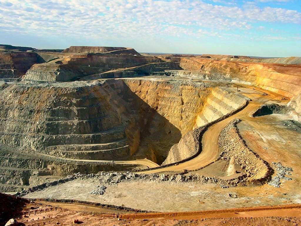
Case Studies from 2025
Western Australia: A mid-tier mining company integrated AI-driven hyperspectral mapping with passive geochemical sampling, discovering a significant REE-bearing monazite deposit in an area previously dismissed as low potential.
Canada’s Northwest Territories: Exploration teams deployed portable spectrometers and eDNA surveys to minimize disturbance in culturally significant Indigenous lands, securing community approval for continued exploration.
Greenland: Hyperspectral imaging from the European Space Agency’s Sentinel-2 satellite guided targeted sampling, reducing exploration costs by over 30% compared to traditional grid drilling.
The Geopolitical Dimension
As nations tighten control over critical mineral supply chains, exploration technology has become a strategic asset. Governments are funding research to ensure domestic exploration capabilities keep pace with global competition.
China, Australia, the U.S., and the EU are all backing public–private partnerships to deploy next-generation exploration tools. Some even share anonymized geospatial data with allied countries to accelerate discovery and reduce redundancy.
A Glimpse Ahead: The Next Five Years
Looking beyond 2025, the integration of quantum-enhanced AI into geochemical exploration could allow for even more accurate deposit modeling, factoring in geochemistry, climate change projections, and economic variables in real time.
Automation is also likely to increase, with autonomous sampling drones capable of collecting and analyzing soil and rock samples without human presence in hazardous or remote regions.
Conclusion:
Geochemical exploration in 2025 is no longer about blind drilling or slow manual surveys—it’s about precision, prediction, and partnership. By merging advanced sampling techniques, AI-driven geospatial analytics, and real-time digital mapping, the industry is finding ways to deliver the minerals we need with less environmental and social cost.
As Mattias Knutsson, Strategic Leader in Global Procurement and Business Development, puts it:
“Exploration technology is more than a competitive edge—it’s a responsibility. The tools we use to find the world’s resources must reflect our values as much as our ambitions.”
Knutsson’s perspective reminds us that innovation should serve both economic needs and environmental stewardship. In the race to secure REE supply, the winners will be those who combine scientific excellence with ethical foresight.
From the Arctic tundra to the Australian outback, the breakthroughs of 2025 are setting the stage for a future where we can mine smarter, explore cleaner, and collaborate better than ever before.